
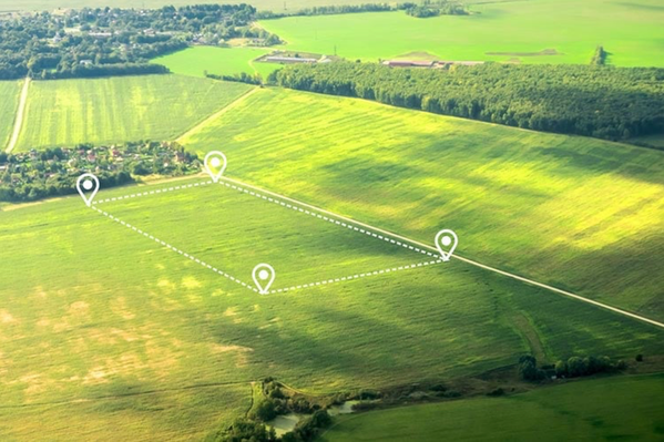
There's a moment in every land transaction when someone stands on a property for the first time. Some see trees, grass, and dirt. Others see stories written in the slope of the ground, lessons in the pattern of erosion, and promises in the way water moves across the surface.
The difference between these two perspectives isn't just experience—it's a learnable skill we call "reading the land." And it's one of the most valuable abilities you can develop whether you're selling inherited acreage, developing a new project, or making your first land investment.
What Does It Mean to Read the Land?
Reading the land goes far beyond a survey or soil report, though those matter too. It's the ability to observe, interpret, and understand what a piece of ground is telling you about its history, its current condition, and its future potential.
Think of it as literacy for the landscape. Just as reading words on a page requires understanding individual letters, grammar, and context, reading land requires recognizing individual signs and understanding how they connect to create meaning.
The best land decisions come from people who've learned this language—who can walk a property and see not just what is, but what was and what could be.
Start With Water: The Land's Most Honest Storyteller
If you want to understand a property, follow the water. It never lies.
Water reveals drainage patterns, identifies flood-prone areas, and shows you where moisture accumulates during wet seasons. In rural and suburban growth corridors, understanding water movement isn't just important—it's essential for development feasibility and long-term value.
What to Look For
- Drainage patterns: Notice where water naturally flows. Look for subtle swales, depressions, and channels that might not be obvious during dry weather.
- Vegetation changes: Areas with different plant species often indicate varying moisture levels. Willows, cattails, and certain grasses signal wet conditions.
- Erosion indicators: Gullies, exposed roots, and sediment deposits tell you how aggressively water moves across the property.
- Seasonal signs: Water stains on buildings, debris caught in fence lines, and sediment lines on trees reveal flood history.
A developer once told us he learned this lesson the expensive way. He purchased what looked like perfect flat land for a residential subdivision, only to discover after engineering studies that the "flat" areas were actually subtle depressions that collected water. Reading those drainage patterns during his first visit could have saved months of redesign work.
Read the Soil: Your Foundation for Everything
Soil isn't just dirt—it's the foundation of value for nearly every land use imaginable.
You don't need a geology degree to start understanding soil, but you do need to pay attention. The soil tells you about load-bearing capacity for construction, agricultural potential, septic system feasibility, and erosion risk.
Simple Soil Assessment Techniques
The texture test: Grab a handful of slightly moist soil. Sandy soil feels gritty and won't hold a ball shape. Clay feels sticky and holds together. Loam feels smooth and holds shape but crumbles easily. Each has different implications for development and agriculture.
The percolation indicator: After a rain, notice how quickly water disappears from the surface. Fast percolation suggests sandy, well-drained soil. Standing water indicates clay or compacted soil—critical information for septic systems and foundation planning.
The color clue: Dark, rich soil often indicates organic matter and fertility. Gray or mottled colors can signal poor drainage or seasonal saturation. Red or orange tones suggest oxidation and typically good drainage.
Professional soil testing remains essential for final decisions, but these field observations help you understand potential and red flags before you invest in detailed studies.
Observe the Vegetation: Nature's Survey Markers
Plants are excellent indicators of land characteristics. They don't just grow randomly—they thrive where conditions suit them and struggle where they don't.
In growth corridors across rural and suburban areas, the existing vegetation can tell you about soil quality, water tables, land use history, and even microclimates that might affect development potential.
What Plants Reveal
Species composition: Native species adapted to local conditions suggest the land has been relatively undisturbed. Invasive species often indicate previous disturbance or poor soil conditions.
Growth patterns: Healthy, vigorous growth indicates good soil and favorable conditions. Stunted or stressed vegetation suggests limitations you'll need to address.
Edge transitions: Pay attention to where one plant community transitions to another. These boundaries often indicate changes in soil, moisture, or topography that matter for development planning.
Historic clues: Old fence rows, tree lines in the middle of fields, or unusual tree spacing can reveal previous property boundaries, old roads, or past agricultural uses.
Study the Topography: Elevation Tells a Story
The shape of the land—its slopes, ridges, valleys, and flat areas—influences everything from construction costs to views to microclimate variations.
Topography determines how easily you can develop, where buildings should sit, how much earthwork you'll need, and which areas offer the most value for specific uses.
Reading the Contours
Even without a topographic map, you can observe important elevation patterns. Stand at different vantage points and notice high and low areas. Walk the property and feel the slopes under your feet. Steep slopes might limit development but offer dramatic views. Gentle slopes provide easier building sites and better erosion control than flat areas or steep terrain.
In rural growth corridors, the relationship between topography and surrounding infrastructure matters enormously. A property at the right elevation relative to existing roads can save tens of thousands in access costs. High points might offer valuable views that justify premium lots.
Consider the Context: The Land Beyond the Boundaries
Reading the land isn't just about the property itself—it's about understanding context.
What's happening on adjacent properties? What direction is growth moving? Where are the utility lines, schools, and services? How does this property fit into the larger landscape?
Questions to Ask
- What are neighboring properties used for, and how might that affect development potential or value?
- Where is infrastructure heading? Which direction is the growth corridor expanding?
- What natural features extend beyond the property lines—watersheds, wildlife corridors, viewsheds?
- How do access points connect to existing roads and future transportation plans?
We've seen landowners focus so intently on their own boundaries that they missed important context—like an adjacent property owner planning a major development that would dramatically change traffic patterns, or a utility extension planned for the next year that would slash development costs.
Learn From the Seasons: Time Reveals Truth
One visit to a property, particularly in favorable weather, gives you an incomplete picture. Land reveals different characteristics across seasons.
That dry creek bed in summer might be a raging torrent in spring. The pleasant tree canopy in summer might block valuable sunlight for agriculture in the growing season. Winter reveals underlying topography that lush vegetation obscures.
If you have the luxury of time, visit the property in different seasons and weather conditions. If you don't, talk to neighbors, look for seasonal indicators, and study aerial imagery from different times of year.
Develop Your Eye: Practice and Patience
Reading the land is a skill that improves with practice. Each property you walk, each conversation with experienced farmers or developers, each topographic map you study adds to your understanding.
Start by simply observing without judgment. Notice patterns. Ask questions. Why does water flow this way? Why do trees grow more vigorously in that area? What caused this erosion pattern?
Build Your Reading Skills
- Walk properties slowly: Resist the urge to rush. Give yourself time to observe details.
- Study maps and imagery: Compare what you see on the ground with topographic maps, aerial photos, and soil maps.
- Ask experts: Farmers, foresters, engineers, and longtime residents can teach you to see things you'd otherwise miss.
- Document observations: Take photos, make notes, and sketch what you see. This practice forces you to look more carefully.
- Return to properties: If possible, revisit the same land in different conditions to see how it changes.
When to Trust Your Reading—and When to Verify
Learning to read the land gives you valuable insight, but it doesn't replace professional due diligence.
Your observations help you ask better questions, identify potential issues early, and make more informed initial decisions. But before finalizing any significant land transaction, verify your field observations with proper surveys, soil tests, engineering studies, and environmental assessments.
Think of reading the land as the critical first chapter in your due diligence story—essential, informative, but not the whole book.
The Highest Purpose Starts With Deep Understanding
At the heart of our mission is helping every acre find its highest purpose. That begins with truly understanding what each piece of land offers and needs.
When you learn to read the land—to see the stories in the soil, the lessons in the water flow, the promises in the topography—you're better equipped to make decisions that honor both the land's character and your vision for its future.
This isn't about imposing your will on unwilling ground. It's about partnering with the land, understanding its strengths and limitations, and finding the uses that align with what it naturally offers.
The developers who build projects that last, the landowners who preserve meaningful legacies, the investors who create durable value—they all share this skill. They've learned to listen to what the land is telling them.
The land speaks to those who take time to listen. The question is whether you're ready to learn its language.
Ready to Put Your Reading Skills to Work?
Understanding land is the first step. Finding the right partner to help you act on that understanding is the next.
Whether you're trying to evaluate inherited property, identify development potential, or make your first land investment, we bring deep expertise in reading land across rural and suburban growth corridors. We've walked thousands of acres, and we'd be honored to share what we've learned.
Let's walk your property together and discover what it's ready to tell us. Reach out today, and let's start the conversation about your land's highest purpose.